A few notes about the trip. The only route that we retraced, or came back the same way we went, was between Stinnett and Borger. The rest of the 1551.4 mile journey was all in one direction. It sort of looks like a pentagon. Below is an overview map, the numbers are on there to ensure that it drew the correct roads. We travled through, Oklahoma, Kansas (my first time), Nebraska (my first time), Wyoming (my first time), Colorado, and New Mexico. I liked the interstate in Nebraska the best, it was 400 miles of light traffic and no towns.
 My sister asked if we took a picture of the sign at the top of Pikes Peak. Honey and Bear have a nice one of them at the top. I said, “no, it was 20 degrees and snowing, we did not take a picture by the sign.” I did capture the conditions, they are below.
Cap riding a big fish in Ft. Collins, yehaw!

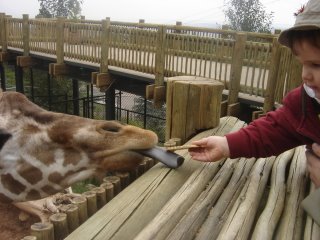
Here is a picture of Cap feeding a giraffe.

This is an Emperor Tamarin, you talk about handle bar mustache, this guy has one!

No comments:
Post a Comment